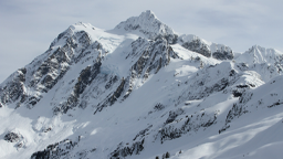
Although the snowpack in the western and southern portions of the Columbia River basin are higher than normal, other areas to the north and to the east are near- to lower-than-normal, and, as a result, January water supplies at key dams are being reported as below or slightly below normal.
That may partially be because the 2025 water year got off to a slow start due to a below normal April to September 2024 runoff in the northern portions of the basin, according to a NOAA water supply briefing late last week. The water year begins Oct. 1 and ends Sept. 30.
“The lower-than-normal runoff is likely driven by groundwater deficits” from last year, said Amy Burke, senior hydrologist with NOAA’s Northwest River Forecast Center, at her monthly water supply briefing, Friday, Jan. 10.
Adding to runoff woes is that temperatures through December and early January across the region have been mostly above normal, she said, and the current 10-day forecast likely won’t improve the water supply situation, either, as it calls for colder temperatures, but lower than normal precipitation.
However, on the positive side, a three-month forecast by NOAA’s Climate Prediction Center is predicting increased chances of cold and wet conditions through March.
In addition, the Climate Prediction Center is also saying that the long-awaited La Niña conditions are here (it showed up in December 2024) and is expected to persist through February-April 2025 (59% chance), with a transition to ENSO-neutral likely during March-May 2025 (60% chance). The Center is not just predicting a short La Niña, it is also predicting a weak one, which will have a weaker influence over temperature and precipitation patterns, a Climate Prediction Center blog says (https://www.climate.gov/news-features/blogs/enso/january-2025-update-la-nina-here).
Burke said in her briefing that the snow water equivalent of the Northwest snowpack this water year is a mix of above and below normal values. Precipitation – Oct. 1, 2024 and ending Jan. 8, 2025 – is above 130 percent of normal through a significant swath of the Columbia River basin, including the Cascade Mountains in Oregon, a SWE high in the John Day watershed of a whopping 241 percent of normal, and southern Washington (high of 157 percent of normal), but tapers off to mostly 70 to 90 percent in the eastern areas of the basin. The basin north of the Canada-U.S. border in British Columbia is near normal to below normal (as low as 59 percent of normal to the east).
Burke’s Water Supply Briefing is here: https://www.nwrfc.noaa.gov/presentations/html/wy2025_ws/WS_Briefing_Page_20250110.pdf
The Natural Resources Conservation Service (USDA) describes the current situation monthly for each state. It wrote in its January Water Supply Outlook Report for Washington that the “while much of the state did receive impacts from several active storm patterns, there were generally less favorable impacts in the central Washington Cascades west of the crest and in parts of the eastern North Cascades. Water year-to-date precipitation in these regions is generally slightly below normal, while snowpack is well-below to near normal.”
The NRCS for Oregon said that “Winter is off to a positive start, with statewide snowpack and water year-to-date precipitation above normal. The fall and early winter so far were marked by nearly 18 atmospheric river events and 2 cyclones that have impacted Oregon. Impacts from several of these storms were more favorable to southern, central, and much of eastern Oregon, evident by more moderate to well-above normal snowpack and WYTD (Water Year to Date) precipitation in those basins as of Jan. 1. At several SNOTEL stations in these regions, the onset of snow accumulation was in the top 5 earliest on record, with snowpack levels in November at many stations within the top 5 on record. Other parts of the state did receive significant impacts from storms, with net snow accumulation from Nov. to Dec. at SNOTEL stations in the northern and central Cascades reaching up to 6.4 ft and up to 6.9 ft in northeastern Oregon. WYTD precipitation in these regions vary from near to above normal.”
Idaho snowpack gained depth through December and early January and is now near normal to above normal, but with most of the snowpack in the southern areas of the state, the NRCS report said. “The snowpack across Idaho saw impressive gains around the holidays with an atmospheric river event bringing ample moisture to the region. Snowpack improved from 70% to approximately 90% of normal in the Snake River headwaters and Henrys Fork-Teton by January 1. Eastern and southern Idaho experienced 110 to 131% of normal precipitation during December. While the snowpack is looking good, especially compared to this time last year, total water year precipitation remains lower than the snowpack percentages due to the abnormally dry, hot October.”
Following a slow start, snowy weather during the last week of December and first week of January drastically improved snowpack conditions in Montana, according to the NRCS report. “The largest snowfall accumulations occurred in western and northwest Montana, while northern Wyoming basins benefited less from the late-December storms. Despite recent improvements, snowpack percentages remain slightly below normal across most of Montana. The exceptions are northwest Montana and the Bears Paw Mountains which have a slightly above normal snowpack. For the rest of the state, the lack of snowfall during October and November created a deficit that will require sustained snowfall to overcome.”
The 2025 water supply runoff measured at the Columbia basin’s storage dams for the first part of this water year (Oct. 1 to Jan. 9) is a mix, according to Burke. Runoff at Libby Dam in Northwest Montana on the Kootenai River is 89 percent of normal, but runoff is just 61 percent of normal at Hungry Horse Dam on the South Fork of the Flathead River, also in Montana.
However, the first of the year water supply forecasts are nearer to normal, Burke said. The forecast for Libby Dam is 5.871-million-acre feet, April through August, 97 percent of the 30-year average (1991-2020), and the forecast for Hungry Horse is 1.908-million-acre feet, April through August, 93 percent of the 30-year average.
According to Burke, runoff and water supply are largely the same, but with a timing difference. Runoff measures what has been observed during the water year Oct. 1 and ending Jan. 9, in this case. It is not a forecast since it has already happened. Water supply is a forecast for a supply of water the region can expect in the future.
British Columbia runoff for the water year is 130 percent of normal at Mica and Duncan dams. The water supply forecasts for Duncan is 1.451 MAF, 85 percent of normal, April through July, and Mica water supply is 85 percent of normal.
At Grand Coulee Dam in the northern part of the Columbia River basin, runoff is 98 percent of normal. In the mid- to upper-Columbia are the Okanogan River at Malott with runoff at 70 percent of normal and the Methow River near Pateros with a runoff of just 63 percent of normal.
Water supply at Coulee is forecasted, April through August, to be 49.638 MAF, 85 percent of the 30-year average. Water supply at the Okanogan River at Malott is 71 percent of normal and the Methow River near Pateros water supply is 60 percent of normal.
Runoff for the water year at Lower Granite Dam, the most upstream of the four lower Snake River dams, is 82 percent of normal, whereas runoff upstream on the Grande Ronde at Troy is 92 percent and at the Owyhee Dam runoff is 125 percent of normal.
Water supply for Lower Granite is 18.007 MAF, April through July, 90 percent of the 30-year average. On the Grande Ronde at Troy, water supply is 111 percent of normal and at the Owyhee Dam it is 87 percent of normal. Further upstream on the Snake River at the American Falls Dam the water supply forecast is just 73 percent of normal.
At Dworshak Dam on the North Fork of the Clearwater River, runoff is 80 percent of normal, whereas the water supply for Dworshak is forecasted to be 2.154 MAF, April through July, 87 percent of normal.
The culmination of all water available upstream in the Columbia and Snake rivers is measured at The Dalles Dam where the water year is 88 percent of normal, and the water supply forecast is 79.356 MAF, April through August, 89 percent of the 30-year average.
Water Supply information is here: https://pweb.crohms.org/tmt/documents/WSF/WSF_WY25_01.pdf
National Weather Service Climate Prediction Center statement on La Niña is here: https://www.cpc.ncep.noaa.gov/products/analysis_monitoring/enso_advisory/ensodisc.shtml
For background, see:
— CBB, June 21, 2024, BASIN SUMMER WATER SUPPLY? RECORD LOW SNOWPACKS IN THE NORTH, ABOVE NORMAL SOUTHERN IDAHO, DALLES DAM RUNOFF 77 PERCENT OF AVERAGE, HTTPS://COLUMBIABASINBULLETIN.ORG/BASIN-SUMMER-WATER-SUPPLY-RECORD-LOW-SNOWPACKS-IN-THE-NORTH-ABOVE-NORMAL-SOUTHERN-IDAHO-DALLES-DAM-RUNOFF-77-PERCENT-OF-AVERAGE/
— CBB, May 17, 2024, DROPPING WATER SUPPLY FORECAST SIGNALS DROUGHT CONDITIONS OVER MUCH OF COLUMBIA BASIN; GRAND COULEE SIXTH LOWEST ON RECORD, HTTPS://CBBULLETIN.COM/DROPPING-WATER-SUPPLY-FORECAST-SIGNALS-DROUGHT-CONDITIONS-OVER-MUCH-OF-COLUMBIA-BASIN-GRAND-COULEE-SIXTH-LOWEST-ON-RECORD/