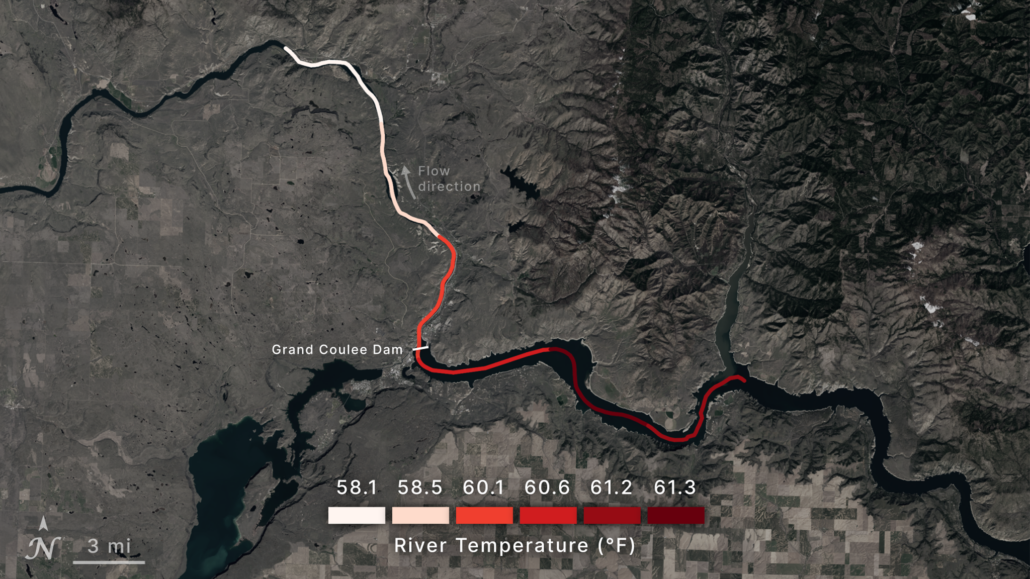
Research Uses 40 Years Of Data From NASA, Landsat Satellites To Track Water Temperatures At Columbia/Snake River Dams Impacting Salmon
New research uses more than 40 years of data from NASA and the U.S. Geological Survey’s Landsat satellites to help dam operators improve the health of salmon fisheries.