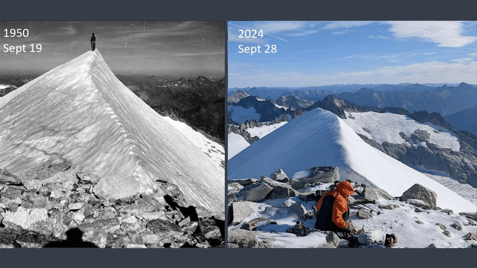
For a century there have been just five places in the continental United States with year-round frozen peaks — all in Washington state. But newly published research documents that these ice-capped summits are changing — melting — faster than many thought possible.
New work from Scott Hotaling from the Quinney College of Agriculture and Natural Resources, in collaboration with Eric Gilbertson from Seattle University, used satellite data, laser measurements and historical photographs to document the ways ice-capped summits in the Western United States are being impacted by climate change.
Since the mid-20th century, the summit of Mount Rainier has declined more than 20 feet, the team found. Columbia Crest is no longer the high point — because of snowmelt, the new summit is now 400 feet to the south. A perennial favorite for technical mountaineers, Mount Rainier is the centerpiece of its namesake national park, the most glaciated peak in the contiguous U.S., and headwater to five major rivers.
Four of the five frozen summits the team measured had lost 20 feet or more in elevation due to snowmelt, with only two still holding year-round ice as their highest point in 2024 — Liberty Cap and Colfax Peak.
“The average air temperature on these summits is significantly higher than it was in the 1950s, almost 5.5 degrees Fahrenheit,” Gilbertson said. “This means there are more and more days that reach above freezing, and we’re seeing ice melt even at the highest elevations.”
The biggest changes for these peaks happened in just the past 30 years, the authors reported. Factors influencing the shifts are increasingly evident — summer temperatures warmed significantly and more precipitation now falls as rain rather than snow.
“This is an obvious and visceral sign of how climate change is impacting these well-known, and once pristine places,” Hotaling said. “It’s pretty shocking that even one of the highest, coldest places in the Western U.S. are seeing the effects of a warming atmosphere. This work adds another layer to a growing list of climate impacts around the world.”
Getting the necessary data for these remote places was a grueling task. Measurements for Columbia Crest required Gilbertson’s team to face 18 miles of terrain, crossing ladders and chasms of ice for the last 10, with 30 pounds of research equipment strapped to their backs. But the effort was necessary to meet the level of accuracy the team required.
“Measurements taken on site used base stations around the state to correct the data. So it gets the number down to the nearest inch,” Gilbertson said.
It is well-documented that the West has been losing glaciers over the past half century — but there is no global inventory of ice-capped summits. Hotaling is working to change that.
“It’s already clear that ice-capped peaks will likely become increasingly rare in the coming years,” Hotaling said.

